-
An interconnection of landscape and logistics
Base Farm
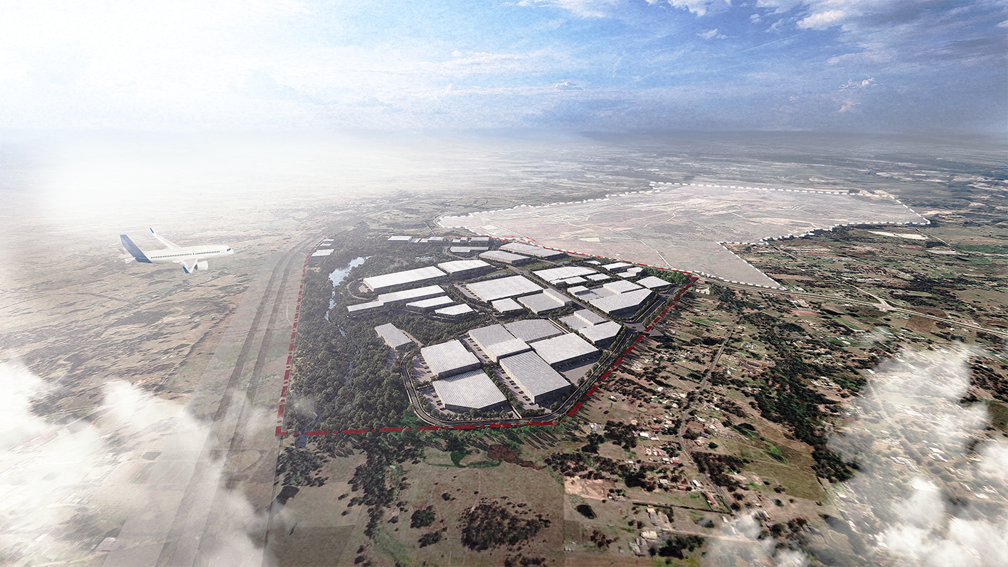
Base Farm is a huge 520-hectare single landholding located immediately adjacent to the new Western Sydney International Airport. The scale of the site and its strategic location can enable a nationally significant, best practice development that fosters productivity, supports airport operations and provides a place for community recreation.
The site has been owned and run by the same family for the last 60 years and currently houses one of the largest dairy farms in the country. At the same time, the development of the new airport has led to the inclusion of the site in a new precinct that will support airport operations. While understanding the economic imperative, the site’s owners saw an opportunity not just to contribute to the economic logics in place around the airport but to create a “once in a lifetime” new recreational precinct in this part of Sydney. TERROIR were appointed in 2022 to act as lead urban designers, heading up a large consultant team to delivery this vision and which also included Yerrabingin (connecting with Country), Matthew Pullinger (urban strategy), Realm Studios (landscape), Urbis (planning), AtelierTen (sustainability) and Costin Roe (engineers), all led by Cerno as project managers.
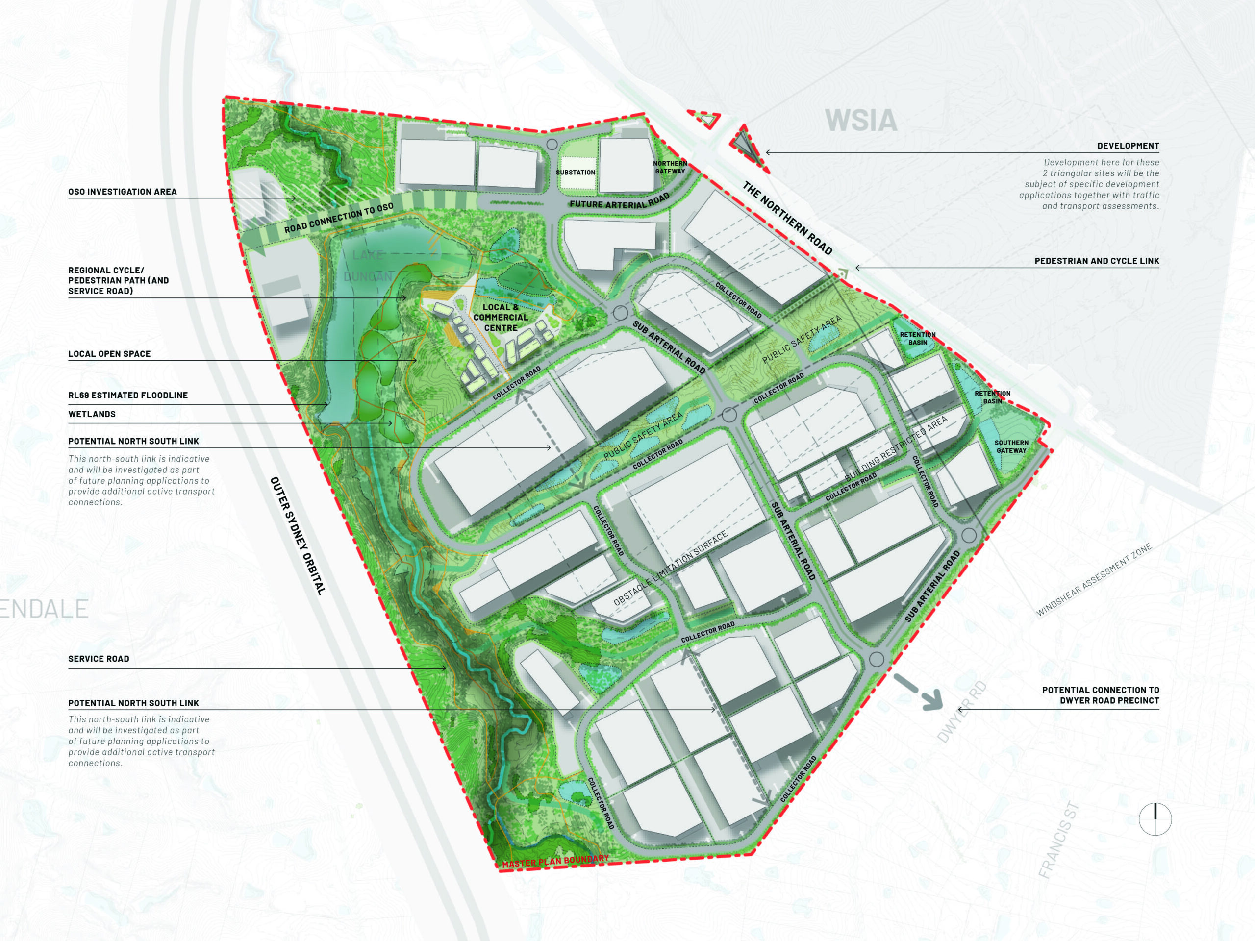
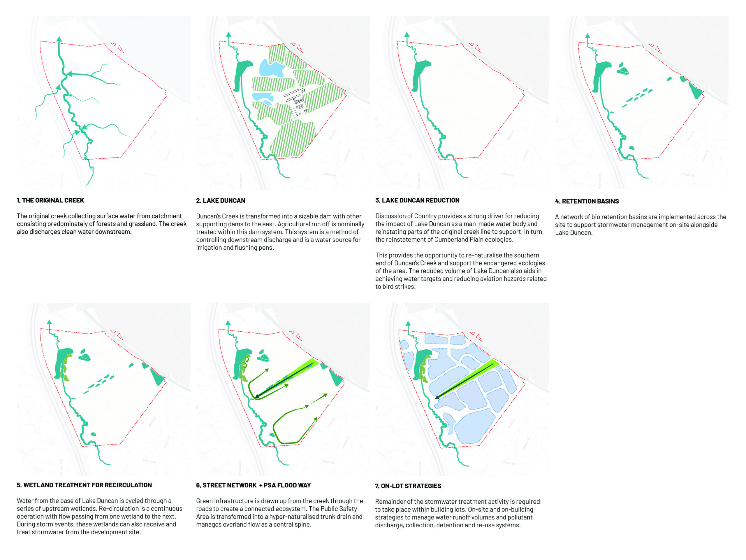
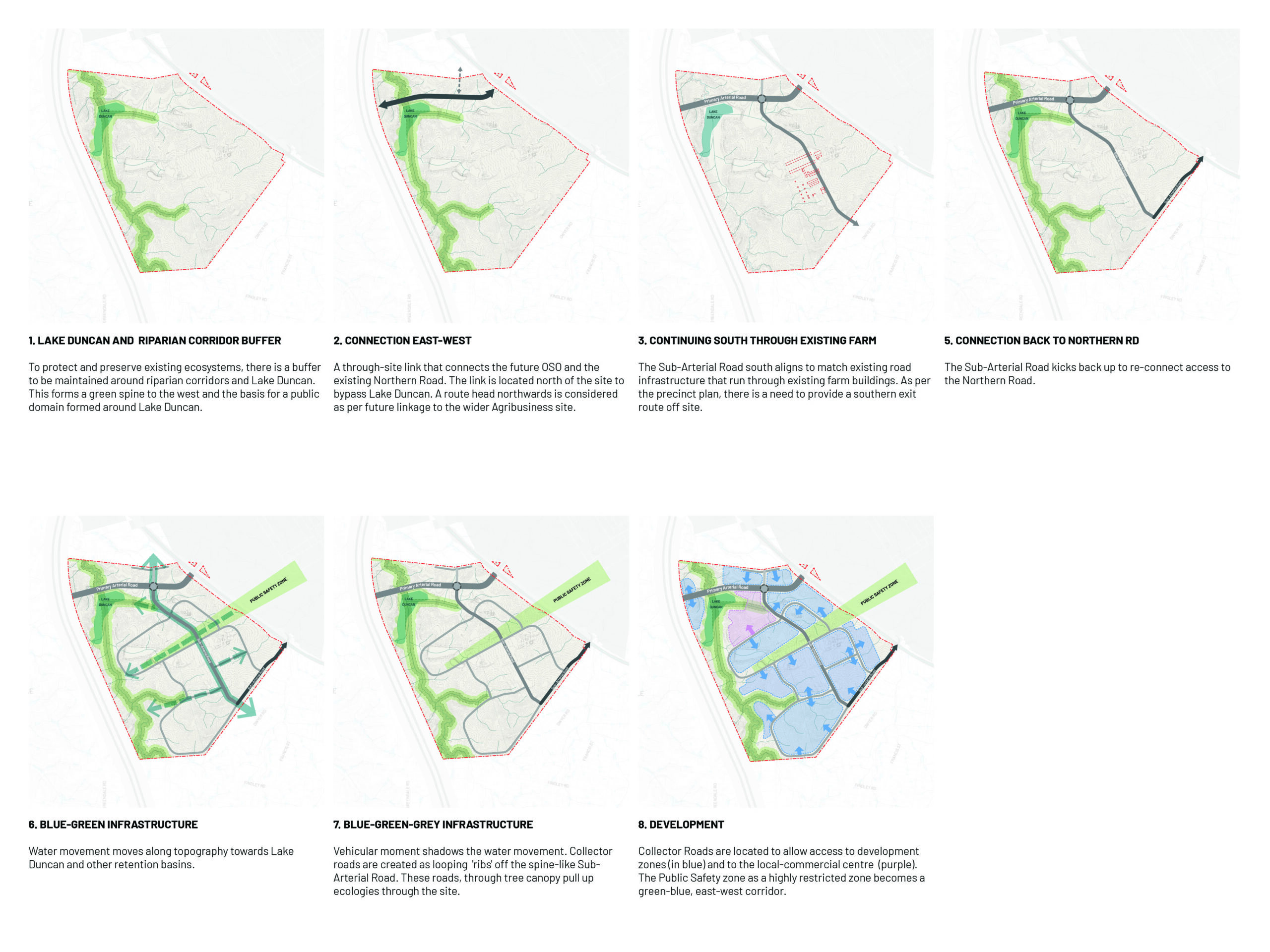
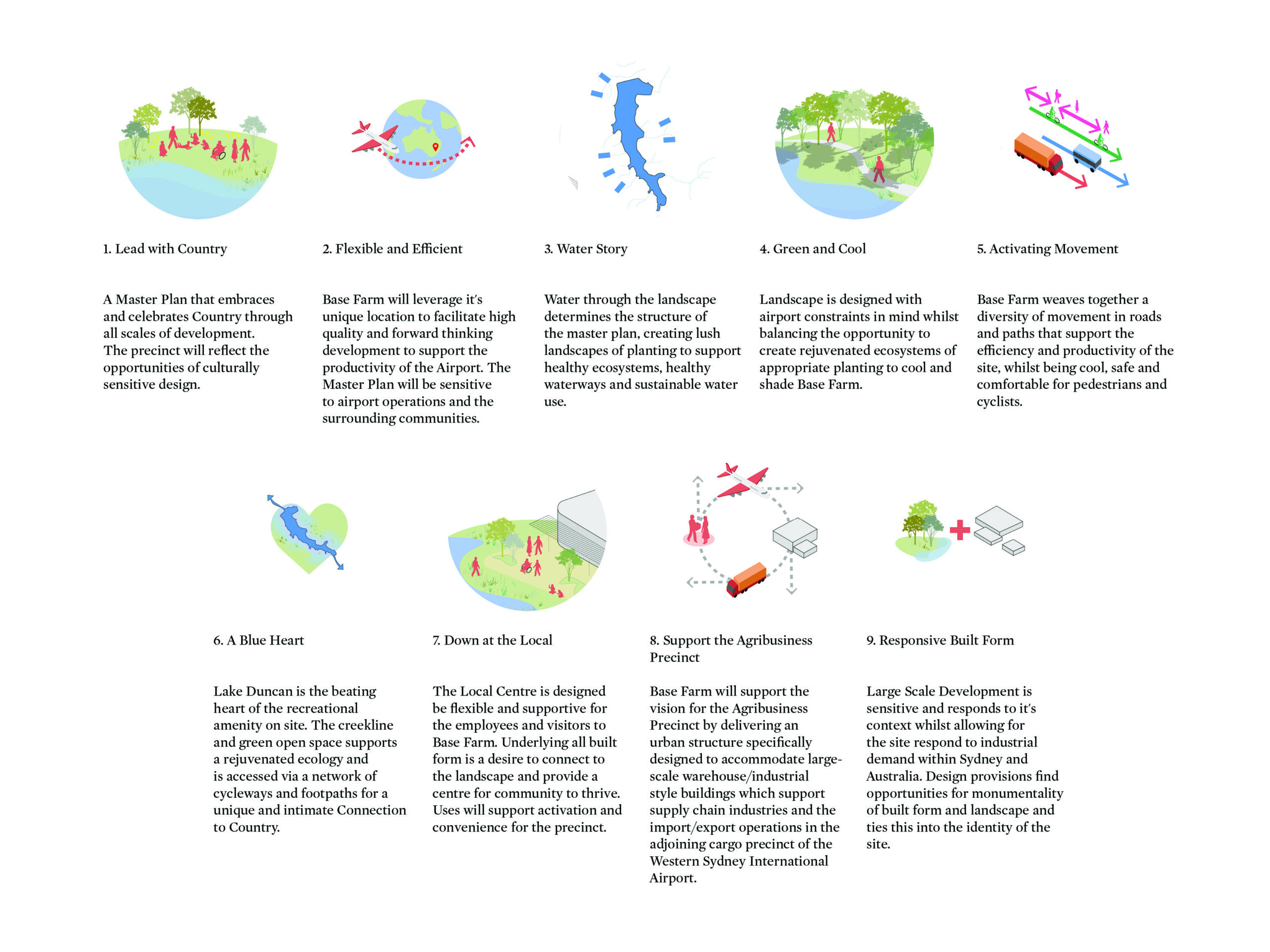
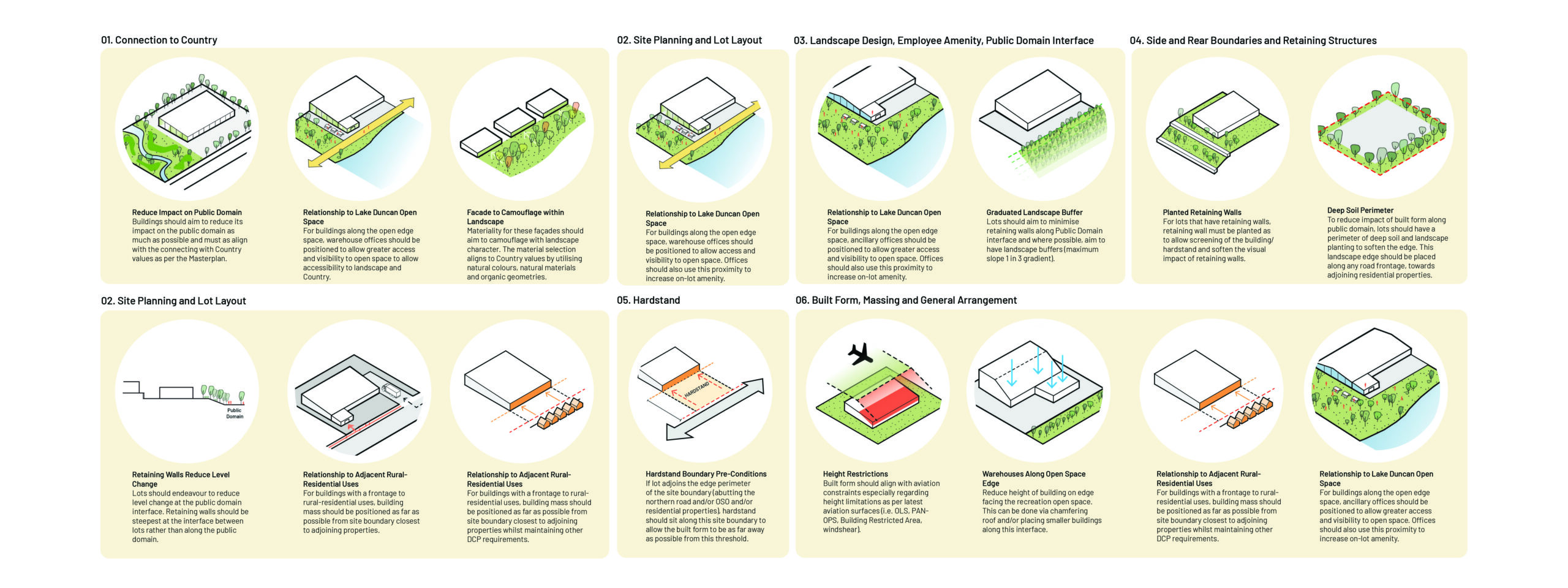
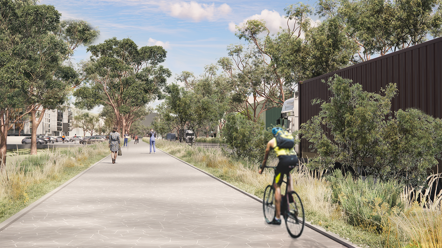
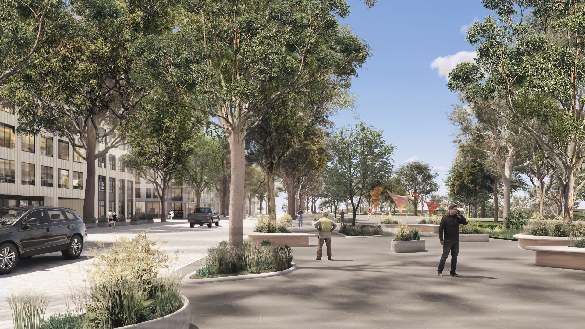
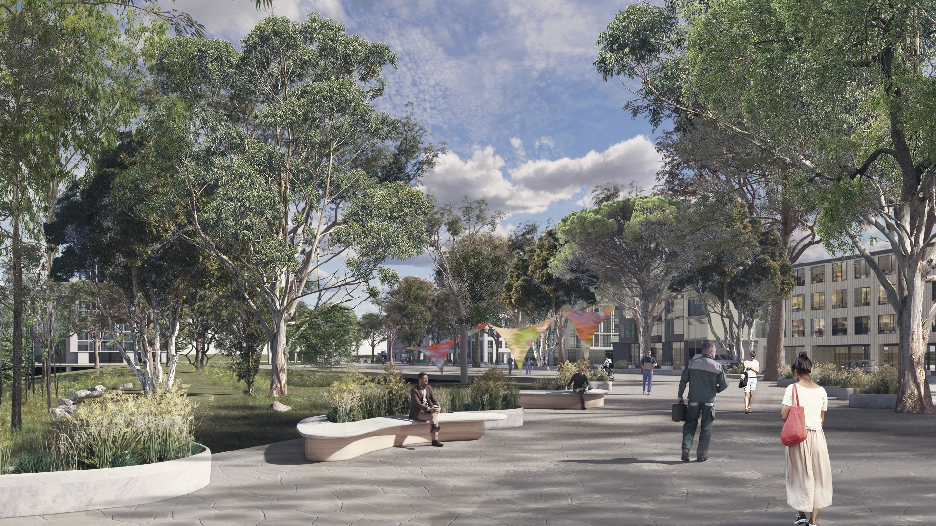
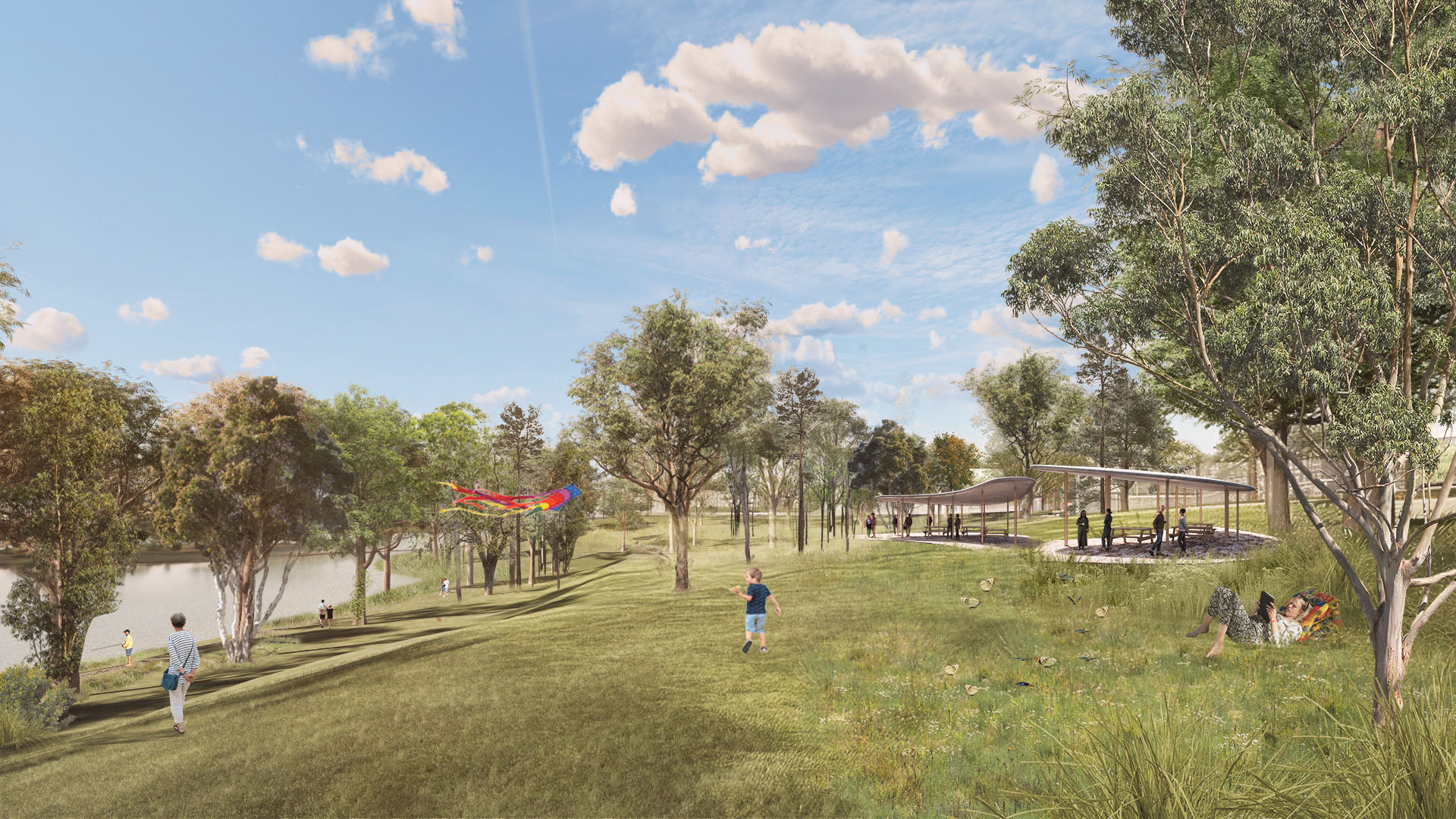
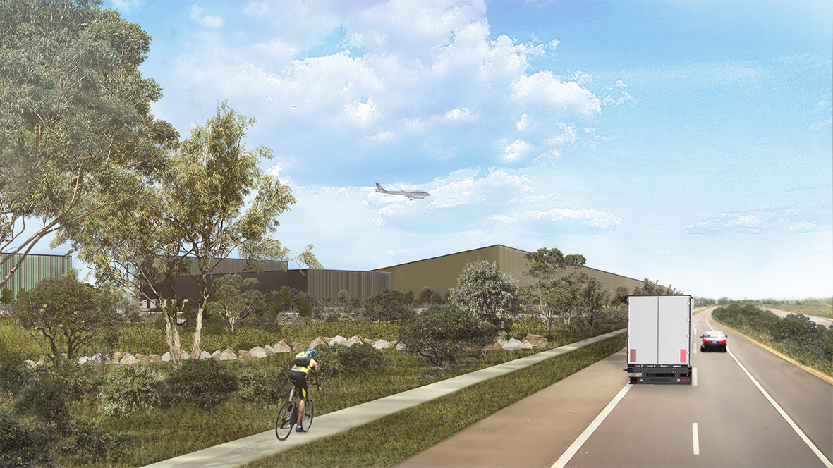
Recovering and restoring the previous creeks on site and associated riparian zones, water is the driving force shaping the approach to the site, creating lush, cooling landscapes to ameliorate increasing heat stress, supported by re-vegetation corridors in riparian zones, along roads and within developable lots and the public domain. The water system is intertwined with a connectivity network – roads, paths and cycleways – which enables the movement of goods around and out of the site while prioritising pedestrian comfort and safety. Around the Lake itself a local centre provides a space both for workers and visitors but also a broader cohort who will be drawn by the largest water body in this part of Sydney as place for recreation and for connecting with Indigenous landscape knowledge.
- TYPE Commercial | Public
- LOCATION SYDNEY | AU
- YEAR 2022-
APPROACH
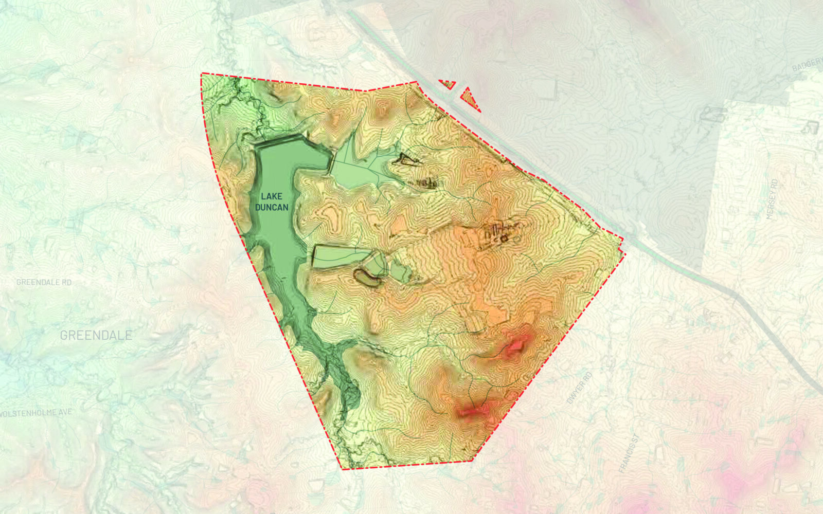
The sloping topography of the site will require significant earthworks to facilitate developable lots for large-scale employment-generating development as envisioned by the planning framework and the land use activities to be accommodated within the Agribusiness zone.
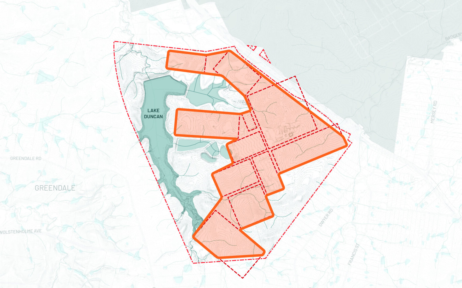
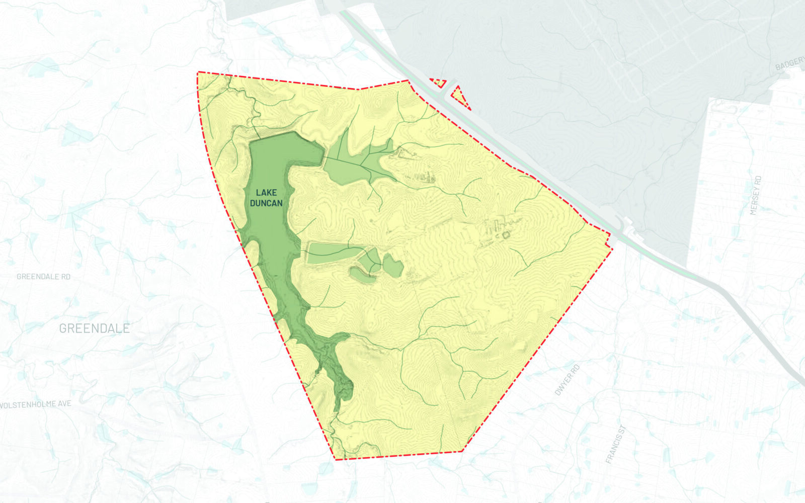
As the site is significantly undulating, isolating the flatter zones of the site would be first steps to finding the best place for development, especially larger footprints, with minimal earthworks. The flatter zones correspond with the grazing paddocks of the farm operations.
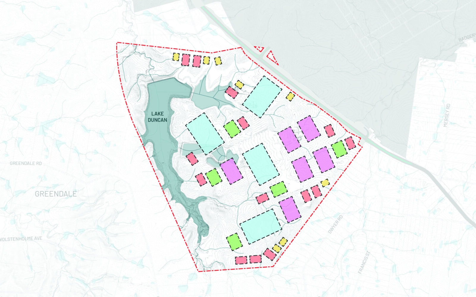
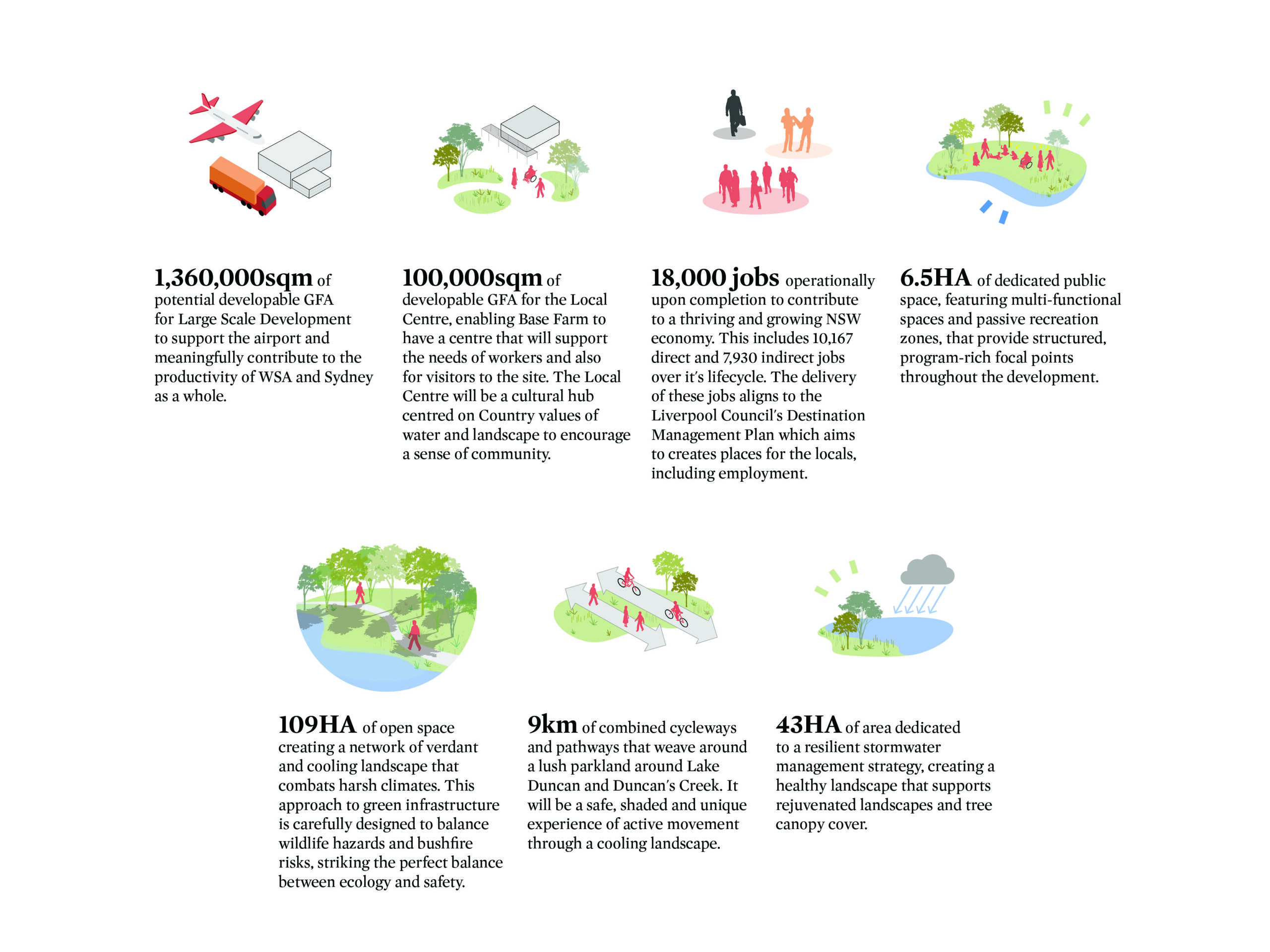
Market feedback on building scale, especially for agribusiness uses, indicate the demand for larger scale footprints compared to those indicated on the Agribusiness Precinct Plan. Ranging from small scale to hyper scale, footprints of 20,000 - 100,000sqm will need to be accommodated to meet with market demand, now and into the future.
Lake Duncan forms the backbone for the site as a key stormwater asset for amenity, stormwater management, stream health and stormwater harvesting. Water flow and collection in Lake Duncan forms divisions on the site that can determine locations of road, public space and development.
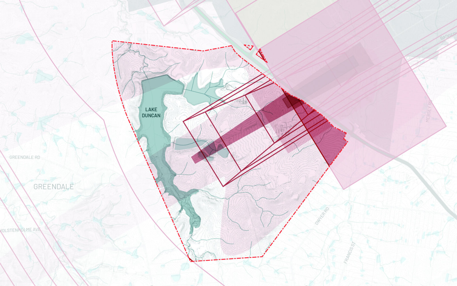
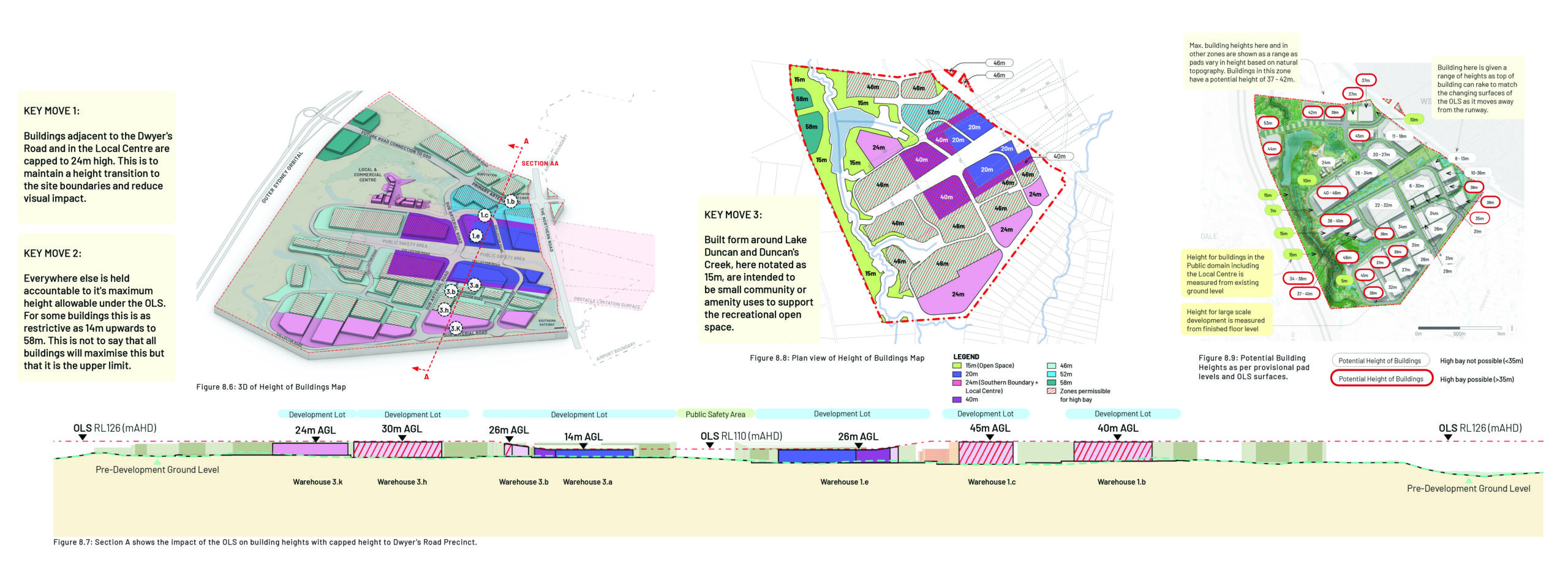
There are numerous aviation controls which fall on the Base Farm site, some of which restrict development and particular uses.
The Base Farm site is under a singular ownership which means that processes for planning, delivery infrastructure is streamlined, cohesive and integrated across the site.
The strategic location of the site adjacent to the new airport led to its identification as a key part of any future logistics and support infrastructure. At the same time, the varied topography on site required negotiation to accommodate increasingly large industrial building footprints. There were also unique external controls such as height constraints due to the flight paths of approaching aircraft.
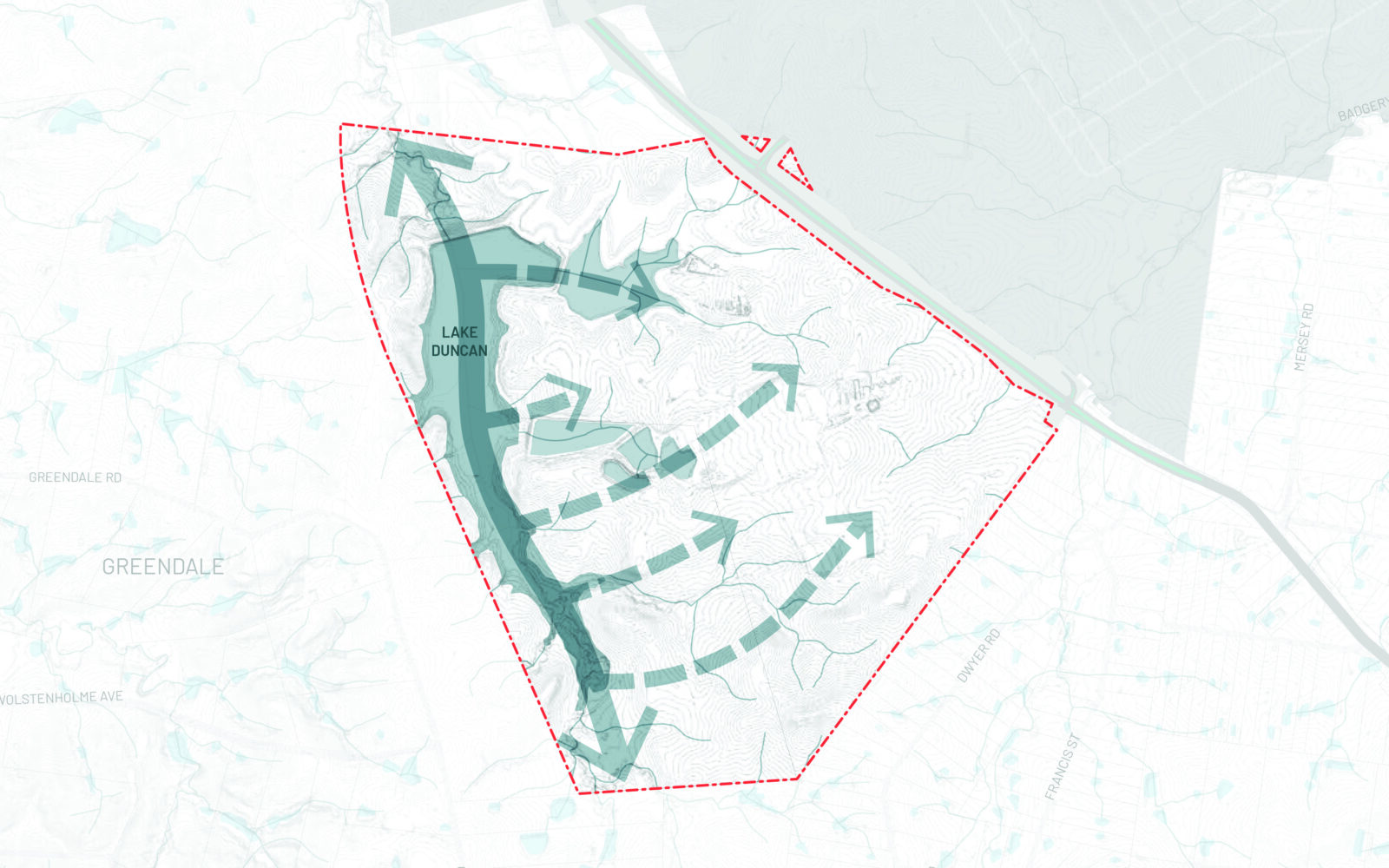
The project was approached from two directions. Working with Yerrabingin and the local indigenous community, we observed how the existing lake was formed around existing riparian corridors that, if repaired and renewed, could recover some of the pre-settlement landscape characteristics. At the same time, we observed that existing farming activities were organised by a deep understanding of the site and its spatial characteristics. Identifying these logics revealed occupation patterns that in turn formed the basis for initial planning, with large lots on the flatter "paddock" areas organised around the steeper riparian zones.
A network of streets works between the external logics of the public safety area (a no-build zone on the runway approach), the embedded site logics of the riparian zones and water body and the logics of the industrial plots which negotiate between them. The renewed and cleaned waterways and landscape provide amenity not just to those working nearby but can support a regional recreation hub. The coherence of the final plan was only possible due to the opportunity of working across all spatial contexts at a very large scale, something only possible due to single site ownership.
GALLERY
DRAWINGS